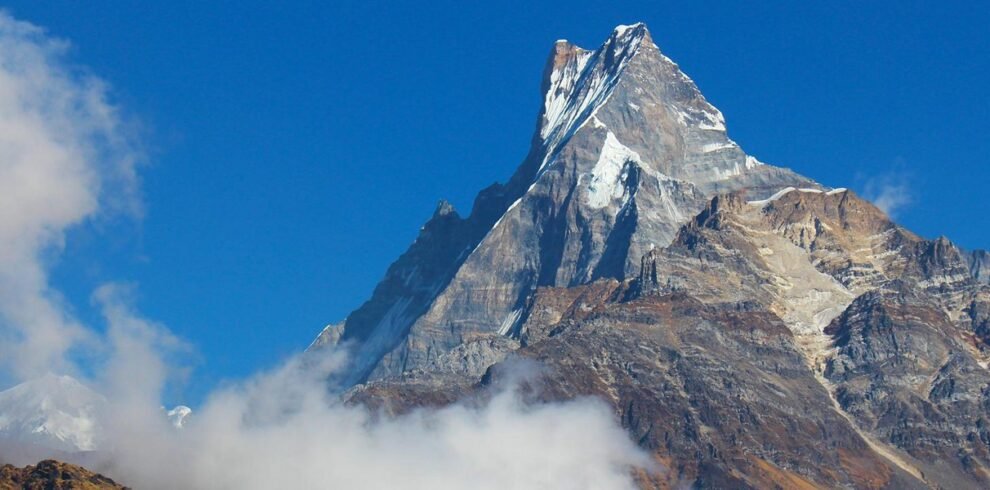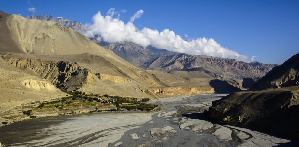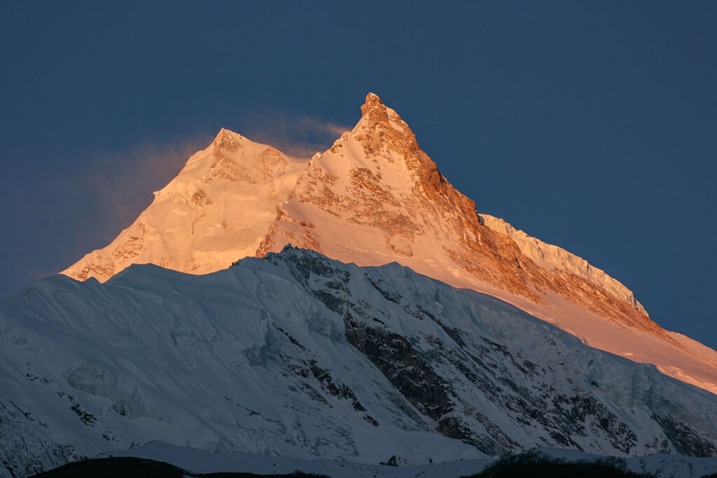
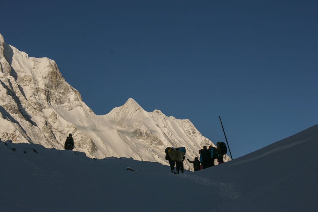
The Manaslu Circuit Trek offers a remote and unforgettable adventure through the untouched beauty of the Himalayas. With stunning views of Mt. Manaslu (8,163m), this trek challenges your endurance as you cross high-altitude landscapes and the dramatic Larkya La Pass (5,160m). Along the way, you’ll explore Tibetan-influenced villages, rich cultural heritage, and breathtaking scenery. Ideal from March to May and mid-September to December, October being the most popular—this off-the-beaten-path trek promises a spiritually enriching and less crowded experience for true adventure seekers.
Trip Info
-
Spring (March to May) and Autumn (September to December)
-
Car/Flight/ Car/ Tourist bus
-
4-5 Hours
-
Hotel / Tea Houses
-
Larkya La Pass at 5,106 meters (16,765 feet)
Overview
The Manaslu Circuit Trek is a remote Himalayan adventure, featuring stunning views of Mt. Manaslu (8,163m) and the challenging Larkya La Pass (5,160m). Trek through Tibetan-influenced villages, experience rich culture, and enjoy breathtaking landscapes. Best from March-May and mid-September-December, it’s a less crowded, spiritually enriching journey for true explorers.
Trip Highlights
- Spectacular views of Mount Manaslu (8,163m) – the 8th highest peak in the world
- Cross the challenging and scenic Larkya La Pass (5,160m)
- Trek through remote and less-crowded Himalayan trails
- Walk along glacial rivers, lush forests, and terraced fields
- A perfect blend of natural beauty, cultural immersion, and adventure
Itinerary
Drive: 8–10 hours
Route
Kathmandu → Arughat → Soti Khola → Machha Khola
Scenery
Terraced hillsides, Trishuli River, Budhi Gandaki valley, rural villages, waterfalls, winding mountain roads, and lush green landscapes.
Overnight
Machha Khola
Trek: 6–7 hours
Route
Machha Khola → Khorlabesi → Tatopani → Dobhan → Jagat
Scenery
River gorges, dense forests, bamboo groves, hot spring area at Tatopani, waterfalls, cliffside trails, and suspension bridges crossing the Budhi Gandaki.
Overnight
Jagat
Trek: 6–7 hours
Route
Jagat → Salleri → Sirdibas → Philim → Ekle Bhatti → Deng
Scenery
Stone-paved villages, cultivated terraces, pine forests, narrow canyons, hanging cliffs, and increasingly rugged mountain terrain.
Overnight
Deng
Trek: 6–7 hours
Route
Deng → Rana → Bihi Phedi → Ghap → Namrung
Scenery
Thick forests of pine and fir, moss-covered trails, mani walls, Buddhist chortens, river crossings, and distant views of Ganesh Himal and Sringi Himal.
Overnight
Namrung
Trek: 4–5 hours
Route
Namrung → Lihi → Sho → Lho
Scenery
Traditional Tibetan-style settlements, barley fields, prayer flags, snow-capped peaks, and the first clear views of Manaslu and Manaslu North.
Overnight
Lho
Trek: 4–5 hours
Route
Lho → Shyala → Samagaon
Scenery
Wide alpine valley, grazing yaks, glacial streams, giant mountain walls, and panoramic views of Manaslu, Himal Chuli, Ngadi Chuli, and Peak 29.
Overnight
Samagaon
Optional Routes
• Samagaon → Birendra Lake → Samagaon
• Samagaon → Manaslu Base Camp → Samagaon
Scenery
Glacial lakes, moraine fields, glaciers, yak pastures, ancient monasteries, and close-up views of Manaslu's north face.
Overnight
Samagaon
Trek: 3–4 hours
Route
Samagaon → Samdo
Scenery
Open alpine terrain, broad valleys, grazing yaks, glacier-fed streams, and expansive views of surrounding Himalayan peaks.
Overnight
Samdo
Optional Route
Samdo → Samdo Ridge / Tibetan Border Viewpoint → Samdo
Scenery
Larkya Glacier, barren high-altitude landscapes, snow-covered ridges, mountain passes, and distant views toward Tibet.
Overnight
Samdo
Trek: 4–5 hours
Route
Samdo → Larkya Bazaar → Dharamsala
Scenery
Rocky terrain, glacial valleys, alpine meadows, moraine fields, and increasingly dramatic mountain surroundings.
Overnight
Dharamsala (Larkya Phedi)
Trek: 8–10 hours
Route
Dharamsala → Larkya La Pass → Bimthang
Scenery
Glaciers, frozen lakes, prayer flags at the pass, vast Himalayan panoramas, ice-covered slopes, and views of Himlung Himal, Cheo Himal, Kang Guru, Annapurna II, and the Manaslu range.
Overnight
Bimthang
Trek: 6–7 hours
Route
Bimthang → Karche → Gho → Tilije
Scenery
Alpine meadows, rhododendron forests, glacial rivers, waterfalls, pine woods, and beautiful mountain valleys.
Overnight
Tilije
Trek: 4–5 hours
Route
Tilije → Thonje → Dharapani
Scenery
Traditional Gurung villages, terraced farmland, mixed forests, suspension bridges, and views of the Marshyangdi Valley.
Overnight
Dharapani
Drive: 5–6 hours
Route
Dharapani → Tal → Syange → Besisahar
Scenery
Deep river valleys, waterfalls, green hills, farming villages, and the Marshyangdi River flowing through dramatic gorges.
Overnight
Besisahar
Drive: 5–7 hours
Route
Besisahar → Dumre → Kathmandu
Scenery
Rolling hills, river valleys, terraced fields, roadside villages, and distant Himalayan views on a clear day.
Includes/Excludes
Includes
- Airport pickup and drop-off in Kathmandu
- All necessary permits: Manaslu Conservation Area Permit (MCAP), Annapurna Conservation Area Permit (ACAP), and TIMS (Trekkers’ Information Management System)
- Domestic transportation: Kathmandu to MachhaKhola and return from Besisahar to Kathmandu by jeep/bus
- Accommodation in teahouses/lodges during the trek (twin-sharing basis)
- Three meals per day during the trek (breakfast, lunch, and dinner)
- Government taxes and service charges
Excludes
- International airfare to and from Kathmandu
- Meals and drinks in Kathmandu (before and after the trek)
- Personal trekking equipment and clothing
- Tips for guides, porters, and drivers
- Travel insurance including evacuation and medical coverage (highly recommended)
- Optional activities or side trips not mentioned in the itinerary
FAQs
General
The trek requires special permits and a licensed guide, reaches high altitudes (5,106 m at Larkya La Pass), and involves basic teahouse accommodation. Good fitness, proper acclimatization, travel insurance, and carrying sufficient cash are recommended. Spring and autumn are the best seasons to trek.
Mostly basic teahouses and mountain lodges with simple rooms, usually twin-sharing, shared bathrooms, and limited hot-water facilities. Some higher-altitude areas have more basic facilities.
It is a challenging trek due to long walking days, high altitude, steep trails, and crossing Larkya La Pass at over 5,100 m. Good physical fitness and proper acclimatization are essential.
Yes,solo travelers frequently join Manasku Circuit Treks, providing opportunities to meet like-minded adventures
Ascend slowly, include acclimatization days, stay well hydrated, avoid alcohol, eat properly, and don’t overexert yourself. Most importantly, never ignore symptoms—if they worsen, stop ascending and descend immediately.
There is generally no fixed maximum age limit, but trekkers must be physically fit and able to handle high altitude. Minors should trek with a parent/guardian, and travel insurance covering high-altitude trekking is strongly recommended.
You need 3 main permits: Manaslu Restricted Area Permit (RAP), Manaslu Conservation Area Permit (MCAP), and TIMS Card. A licensed trekking guide and registered trekking agency are also required.
Yes. A licensed trekking guide is compulsory for the Manaslu Circuit Trek, and the trek must be arranged through a registered trekking agency.
Essential equipment includes trekking boots, warm/down jacket, thermal layers, waterproof clothing, sleeping bag, trekking poles, gloves, hat, sunglasses, headlamp, water bottle, sunscreen, first-aid kit, and personal medicines.
Mobile network is available in some lower and mid-altitude areas, but coverage becomes limited or unavailable at higher elevations. Wi-Fi may be available at some teahouses, but it can be slow and unreliable.
The best seasons are March–May (spring) and September–November (autumn), offering stable weather, clear mountain views, and suitable trekking conditions. October–November is generally considered the best period.
Major attractions include Mt. Manaslu, Larkya La Pass, Manaslu Conservation Area, traditional Gurung and Tibetan villages, Samagaon, Birendra Lake, dramatic Himalayan landscapes, monasteries, and the beautiful Budhi Gandaki Valley.
Yes, travel insurance is strongly recommended and should cover high-altitude trekking, medical treatment, and emergency helicopter evacuation. Always check the policy’s altitude and trekking limits before purchasing.
Manaslu Circuit Trek generally costs around USD 1,000–1,500 per person, depending on the season, accommodation, guide/porter, permits, transportation, and services included.
Yes, helicopter evacuation/return is possible from various points on the Manaslu Circuit, subject to weather, helicopter availability, landing conditions, and permits. It is commonly used for emergencies or altitude sickness, and the cost is usually high, so travel insurance covering helicopter evacuation is strongly recommended.
Teahouses mainly serve Dal Bhat, noodles, pasta, fried rice, momos, soups, potatoes, eggs, bread, porridge, and seasonal vegetables. Tea, coffee, hot lemon, and other hot drinks are also widely available. Food options become more limited at higher altitudes.
Extensive training is not required, but good physical fitness and regular walking/cardio training are important. Preparing for long uphill walks and carrying a light backpack will help you handle the high altitude and Larkya La Pass more comfortably.
It is not recommended to drink tap or untreated water directly. Use filtered, boiled, or properly treated water and carry purification tablets or a portable filter. Avoiding untreated water helps prevent stomach infections during the trek.
It is not ideal for complete beginners because of high altitude, long trekking days, and the challenging Larkya La Pass. However, beginners with good fitness, proper preparation, and a guided itinerary can complete it successfully.
The highest point is Larkya La Pass, approximately 5,100–5,200 meters (16,700–17,060 feet) above sea level. The trek also reaches Samagaon at about 3,530 m and Samdo at about 3,875 m.
Internet access is limited and unreliable, especially at higher elevations. Some teahouses offer Wi-Fi for a fee, while mobile data may work in lower villages; it is best to download important information and maps offline before the trek.
The trek usually takes 14–16 days, depending on the itinerary, acclimatization days, transportation, and weather conditions.
-You should have good cardiovascular fitness and endurance to walk around 5–7 hours a day, often on steep and uneven terrain. Regular hiking, walking, stair climbing, and strength training for 6–8 weeks before the trek is recommended.
A 20–30% advance payment is generally required to confirm the booking; cancellation charges increase as the departure date approaches, while the deposit is usually non-refundable. Exact refund terms depend on the trekking agency’s policy.
No, not widely. Cards and online payments may be accepted at some teahouses and larger villages, but cash (Nepali rupees) is strongly recommended, especially in remote and higher-altitude areas.
Tipping is not compulsory, but it is customary and appreciated for guides, porters, and trekking staff who provide good service. The amount is usually based on the quality of service and group size.
Temperatures vary greatly with altitude. Lower areas can be 10–25°C during the day, while higher areas around Samagaon and Larkya La can drop below 0°C, especially at night. Near Larkya La, temperatures may reach around −10°C or lower in winter, so warm layers and proper winter gear are essential.
The road distance from Kathmandu to the Manaslu trekking starting point (Machha Khola) is approximately 160–180 km, depending on the route and road conditions. The journey usually takes around 7–9 hours by road.
You can experience Gurung and Tibetan-influenced culture, traditional villages, ancient monasteries, prayer wheels, mani walls, local festivals, traditional foods, and warm hospitality from mountain communities along the trail.
No. Domestic flights are not required; trekkers can travel by road from Kathmandu to Machha Khola, the common starting point of the trek.